Uyuni, Bolivia
September 12, 2004
La Paz to Potosi
 To be fair, I’m not fond of big cities on a motorcycle; particularly big Latin
cities. There have been some exceptions, Guadalajara, Mexico, which I found to
be beautiful, comes to mind, but generally they are terribly congested, the
traffic is unbearable, and because of a lack of street signs I find it
impossible to find my way around. Frequently I’m forced to resort to my taxi
solution.
To be fair, I’m not fond of big cities on a motorcycle; particularly big Latin
cities. There have been some exceptions, Guadalajara, Mexico, which I found to
be beautiful, comes to mind, but generally they are terribly congested, the
traffic is unbearable, and because of a lack of street signs I find it
impossible to find my way around. Frequently I’m forced to resort to my taxi
solution.
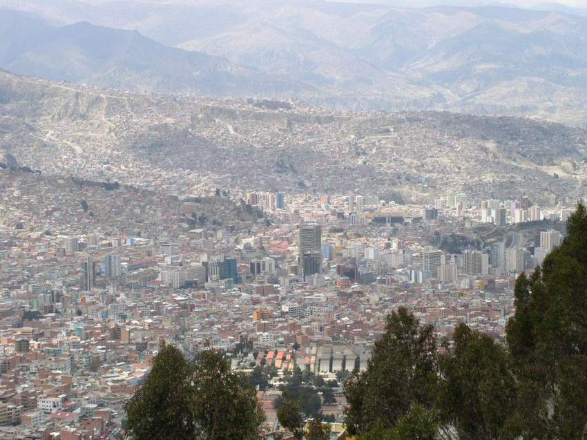
So La Paz is no different. With a population of over a million, the city is
tightly constricted in a bowl about 300-400m (1,000-1,200’) below the rim of the
surrounding Altiplano. The core of the city is in the center of the bowl and it
spreads up the flanks of the crater, right to the top of the rim.
The traffic is some of the worst that I’ve ever encountered, with the streets
positively clogged with white Toyota minivans, which are used as a private bus
system. In each van, at the top of his voice to be heard above the other
traffic, a caller hangs out the sliding side door and in rapid-fire Spanish
shouts out the destination for his van. With dozens of these vans trapped on any
given block, the result is the most annoying din imaginable.
When I finally find the hostal, I discover that I must mount four steps to a
small landing, then another two steps to get the bike securely into the
courtyard. (Where’s a camera when you need it?) The receptionist calls a
maintenance man who in turn brings two six-foot long, badly worn 2” x 6” boards,
which I’m supposed to ride up. Imagine riding a 650 pound (as loaded) motorcycle
up a 2” x 6”! It would have to be someone better than me. I ask for the 2” x 6”s
to be laid length wise to create smaller steps, we add some tiles for additional
steps, then with the help of three men we “ride” and lift the bike into the
hotel.
Add to all of this the fact that not much English is spoken, that there is a
large and very obvious military presence, and I concur with an America graduate
student, now three years in Bolivia working on a PhD in anthropology, and a
guest at the hostal, who describes La Paz as “edgy.”
I’m worried about the tail rack again, and although the rebar installed in the
“Inca Solution” continues to hold, the top box seems to have more bounce than it
did. I’m sure the bouncing will eventually break the weld or snap the bolts that
are holding the rear fender and taillight assembly in place. Also, I’ve been
nearly four weeks on the road by myself, and I miss Jan and the rest of my
family a lot. Finally, I’ve heard and read horror stories of the roads in
southern Bolivia – hundreds of miles of gravel and dirt. So……hello, La Paz!
 But I’ve got things to do, so after moping around for a half day, I set about
it. There’s an Aero Argentina ticket office just a few blocks from the hostal
and I easily change my flight date out of Buenos Aires. ATMs dispense cash in
both US dollars and bolivianos, so I replenish my cash. In the meantime I decide
that I need to empty the top box of all weight, and to accomplish that donate
some guide books and maps to the hostal library, toss some unnecessary
equipment, and trust the Bolivian postal system with a package for home.
But I’ve got things to do, so after moping around for a half day, I set about
it. There’s an Aero Argentina ticket office just a few blocks from the hostal
and I easily change my flight date out of Buenos Aires. ATMs dispense cash in
both US dollars and bolivianos, so I replenish my cash. In the meantime I decide
that I need to empty the top box of all weight, and to accomplish that donate
some guide books and maps to the hostal library, toss some unnecessary
equipment, and trust the Bolivian postal system with a package for home.
Again I remove the top box to determine how much more damage has been done, and
in the process find a way to strap the box to the rebar to mitigate the
bouncing. Now with nothing in the top box, I realize that worst case is that I
eventually leave it by the side of the road and strap the fender and taillight
assembly to the frame. Mentally, that gives me a big lift.
I’ve also come to terms with the roads. Depending on which route I take, I have
between 600 and 800 miles to ride to reach Argentina, where I’ve been advised
that the main roads are paved. With the extra week I have a full seven days to
cross the south of Bolivia. I set out.
On to Potosi
It’s just 120 miles across the Altiplano to Ururo, and I’ve heard the road is
paved, so I get a nice early start, clear the two military checkpoints with a
wave of the hand, leave La Paz and head south. Not only is the road paved, but
less than ten miles south of La Paz it’s newly paved. With the exception of some
construction, it’s a ribbon of new asphalt all the way to Ururo, and I make the
120 miles in three hours, clearing the far side of Ururo by noon.
 Generally I don’t eat lunch when I’m riding, not wanting to waste the daylight,
but I’ll make a five-minute stop for cookies or candy and some water. Well
outside of Ururo I stop at the last tienda de barrio (literally, the
neighborhood store) before the highway heads for the desert and on to Potosi.
Neither cookies nor chocolate are in inventory, so I drop my standards
considerably and ask for a banana. Several bunches look quite nice. “Uno
boliviano,” says the old lady in full Indian dress, sitting in an aging plastic
chair. “Si,” I say, and reach for a one-boliviano coin (approximately USD
$0.12.) “Gracias,” she says, and hands me the bunch. “No,” I protest, as I pull
a single banana from the bunch and hand the rest back. She is clearly perplexed,
as twelve cents buys the whole bunch. Figuring that one banana isn’t enough for
lunch I ask for a roll (they serve great bread rolls in Peru and Bolivia) and
say “cuanto questo,” asking the price. Clearly embarrassed by the one-sided
transaction, the old lady hands me the bread, a second banana, and sends me on
my way. I swing my leg over the Beemer, quickly punch through six gears and head
across the Altiplano at about seventy miles per hour on a great road. Things are
looking up in Bolivia.
Generally I don’t eat lunch when I’m riding, not wanting to waste the daylight,
but I’ll make a five-minute stop for cookies or candy and some water. Well
outside of Ururo I stop at the last tienda de barrio (literally, the
neighborhood store) before the highway heads for the desert and on to Potosi.
Neither cookies nor chocolate are in inventory, so I drop my standards
considerably and ask for a banana. Several bunches look quite nice. “Uno
boliviano,” says the old lady in full Indian dress, sitting in an aging plastic
chair. “Si,” I say, and reach for a one-boliviano coin (approximately USD
$0.12.) “Gracias,” she says, and hands me the bunch. “No,” I protest, as I pull
a single banana from the bunch and hand the rest back. She is clearly perplexed,
as twelve cents buys the whole bunch. Figuring that one banana isn’t enough for
lunch I ask for a roll (they serve great bread rolls in Peru and Bolivia) and
say “cuanto questo,” asking the price. Clearly embarrassed by the one-sided
transaction, the old lady hands me the bread, a second banana, and sends me on
my way. I swing my leg over the Beemer, quickly punch through six gears and head
across the Altiplano at about seventy miles per hour on a great road. Things are
looking up in Bolivia.
I’ve mentioned the Altiplano at least twice before without an explanation, and
as this is essentially a travelogue and not a geography dissertation, please
excuse me as I rely on my Lonely Planet guide and verbal information for many of
my facts and figures.
The Altiplano is a high plateau that stretches about five hundred miles from
southeastern Peru around Lake Titicaca, south to northern Chile and Argentina.
Its primary features are extreme dryness and high altitude (averaging around
3,700m [just over 12,000’,]) although it is as high as 4,600m (15,000’) in its
far southern reaches. (Note: I may have misstated the elevation in an earlier
journal. 4,600m (12,000’) appears to be about the average elevation.) So in
laymen’s terms, it is a very high desert that is cold, windy and sparsely
populated. I’m fortunate to be visiting in September, one of the milder months
of the year.
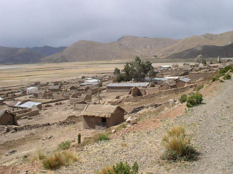
As I ride the seventy miles south from Oruro to the village of Challapata, the
best visual description I can muster, is that the Altiplano most resembles the
Great Basin of the western United States, and more specifically Route 20 (the
Loneliest Road in America) across central Nevada, except 6 – 8,000’ higher. The
flat desert floor, windswept and with little vegetation save sagebrush and some
grass, gives way to low hills at a distance of a few miles. Some sheep, llamas
and alpacas graze on the barren land, helping to sustain the few Indians that
dare to call this high desert home. A few adobe houses dot the landscape. The
road is good, though, and I continue on to Potosi at a decent speed.
At Challapata, engulfed in a dust storm as I pass through, the main road
abruptly turns east and through the mountains of the Cordilleras de Azanaques
and de los Frailes (that reach heights of 5,200m [17,000’]) for the last 210km
(130 miles) into Potosi. It’s a lonely road, with only two or three small
villages of adobe houses as a reminder of human existence. In turn I get rain,
sun breaks, rain, sleet and sun again as I make my over the 4,300m (14,000’)
pass that leads to Potosi. The highway that I’m told was rough gravel as little
as a year ago is now brand new asphalt. For that I’m thankful, as I’m able to
complete the 550km (340 miles) from La Paz to Potosi is less than eight hours.
Not only is it nice to put some miles behind me, but also the good road and good
progress gives my spirits a lift.
A word about Potosi
 At an altitude of 4,090m (13,200’) and a population of over 100,00, Potosi is
reputed to be the world’s highest city of its size. Also, for a time during
Spanish rule it was the largest and most wealthy city in South America because a
mountain right behind town was loaded with silver; discovered around 1545. The
Spanish seized the small mine, developed it, and established a mint (Casa Real
de la Moneda) that produced silver coins beginning in 1572 until it was finally
closed and turned into a museum around 1960. In the meantime, Bolivia won its
independence from Spain in 1825, so coins from this mint were produced both for
Spain and Bolivia. Of course the silver eventually played out, and while limited
silver mining continues on a small scale, the local economy now revolves around
the extraction of tin and other minerals.
At an altitude of 4,090m (13,200’) and a population of over 100,00, Potosi is
reputed to be the world’s highest city of its size. Also, for a time during
Spanish rule it was the largest and most wealthy city in South America because a
mountain right behind town was loaded with silver; discovered around 1545. The
Spanish seized the small mine, developed it, and established a mint (Casa Real
de la Moneda) that produced silver coins beginning in 1572 until it was finally
closed and turned into a museum around 1960. In the meantime, Bolivia won its
independence from Spain in 1825, so coins from this mint were produced both for
Spain and Bolivia. Of course the silver eventually played out, and while limited
silver mining continues on a small scale, the local economy now revolves around
the extraction of tin and other minerals.
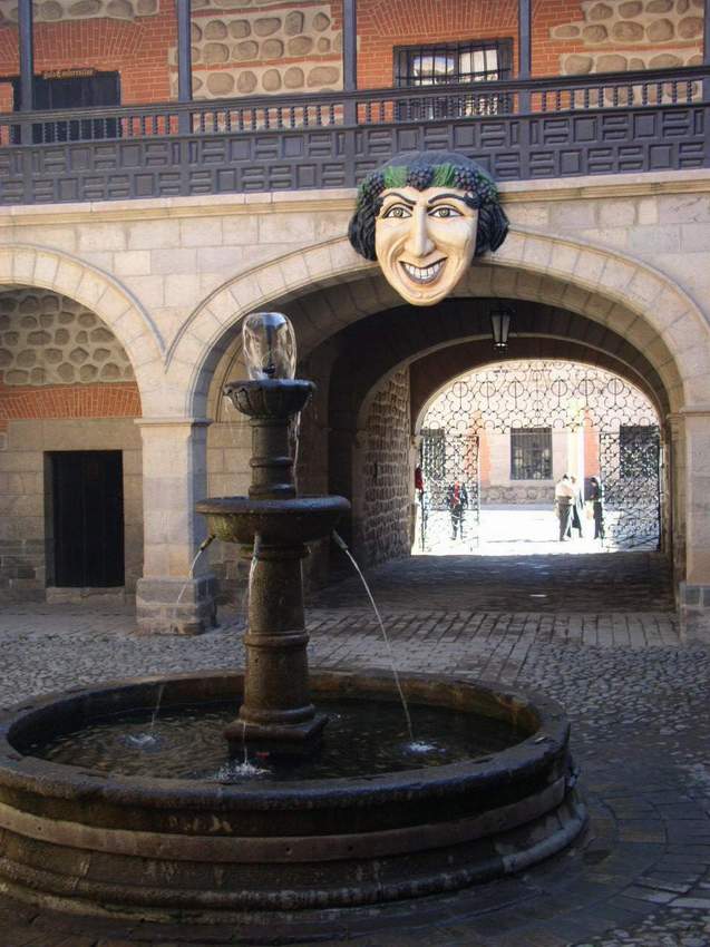
I’m only in Potosi for the night, but enjoy the city with its narrow streets and
colonial buildings dating from the 16th and 17th centuries. Friday morning,
before leaving for Uyuni, I take the time to tour Casa Real de la Moneda. We’re
reminded during the tour, but I’m quoting directly from Lonely Planet “that
between 1545 and 1825 as many as eight million African slaves and Indians died
in the extraction and production of silver as a result of the appalling
conditions in the Potosi mines.”