Ushuaia, Tierra del Fuego, Argentina
December 28, 2004
Ruta 3 – on to Rio Gallegos
To Camarones
 I write and enjoy a walk on the beach with my free day, but I’ve added a penguin
colony south of Trelew to my itinerary and I’m planning an early start on
Tuesday morning.
I write and enjoy a walk on the beach with my free day, but I’ve added a penguin
colony south of Trelew to my itinerary and I’m planning an early start on
Tuesday morning.
As I pack the bike, a man emerges from a 90-ish, yellow Mercedes sedan and stops
to talk. His baby is in a stroller while his attractive young wife continues to
pack the car. Admiring the bike, he wonders about the places that I’ve traveled.
He is a petroleum engineer from the Patagonian city of Comodoro Rivadavia, in
the heart of Argentina’s oil fields, which I will pass through in a day or two.
In the course of our conversation he advises me with some pride that Argentina
is self-sufficient in petroleum production, and even exports a little to
neighboring countries. He also notes that the price of gasoline will drop in
half as I enter the petroleum region; a welcome relief I note, even though
gasoline prices are not unreasonable in Argentina. (Note: outside the oil
regions, the price for Super unleaded is approximately two pesos per liter. That
translates to about USD$2.50 per American gallon.) In a quick poke at my New
England friends, he speaks excellent English in spite of having lived in Boston
for three years. He doesn’t say why he was there. However, he offers that he
owned a motorcycle for several years and sold it to raise a family. What a
strange concept.
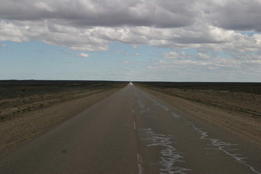
As I clear the pueblo of Las Grutas and nose the big twin south on Ruta 3, I’m
headed for Trelew, about 250 miles (400km) south, and from there down sixty
miles (100km) of gravel to the Magellanic Penguin Colony at Punta Tombo. I hope
to continue south on gravel to the very small village of Camarones, and then
back to pavement north of Comodoro Rivadavia. It appears to be a 120-mile
(200km) detour on gravel, but it’s not every day that you get to visit penguins.
 The wind, blowing directly from the west, and hitting me on the ride hand side
as I ride south, has picked up considerably. The bike is starting to move around
with the gusts, and even the steady wind has the bike heeled to the right at an
angle of ten degrees or more. I continue the long, monotonous ride through the
scrublands that are eastern Patagonia. (Note: Patagonia is not a political
district, but rather an area of southern Argentina below the Rio Negro and above
the province of Tierra del Fuego. It encompasses three Argentine provinces.
Spectacular in the west along the Andes, Patagonia is a virtual wasteland in the
east.)
The wind, blowing directly from the west, and hitting me on the ride hand side
as I ride south, has picked up considerably. The bike is starting to move around
with the gusts, and even the steady wind has the bike heeled to the right at an
angle of ten degrees or more. I continue the long, monotonous ride through the
scrublands that are eastern Patagonia. (Note: Patagonia is not a political
district, but rather an area of southern Argentina below the Rio Negro and above
the province of Tierra del Fuego. It encompasses three Argentine provinces.
Spectacular in the west along the Andes, Patagonia is a virtual wasteland in the
east.)
As an aside here, for you non-motorcyclists, we need to talk about the effects
of the wind on a bike. In any vehicle, the wind tries to push you in the
direction that it’s blowing. It’s just more pronounced on two wheels. Obviously,
if it’s blowing from west to east, it pushes you east. To compensate on a bike,
you lean the bike into the wind. So if the wind is blowing from the west (in
this case) you compensate by leaning the bike to the west to ensure that it
continues south in a straight line. Although the effect of the wind is
different, the lean is essentially the angle of heel that you experience on a
sailboat. As the wind picks up, then, you are going in a straight line while the
top of the bike is slightly to the west (several inches, depending on the
velocity) of the wheels where they make contact with the pavement. At low
velocities it’s no big deal, but as the speed increases, riding gets a bit
dicey.
We also need to temporarily leave the road for three quick geography lessons.
This first lesson has little to do with this story, but it’s interesting. Most
of us living in the United States and Canada think of South America as being
directly south of us. That’s not correct. The west of South America is actually
directly south of the United States’ eastern seaboard. Lima, Peru, on the west
coast of South America is directly south of Miami, Florida. The time zone for
Buenos Aires is five hours east of Seattle and Los Angeles, but only three hours
west of London. Of course, you geography buffs will already know all this.
 The second and third lessons have direct bearing on the story. First, the
continent narrows dramatically as you move south. At least 3,000 miles (5,000km)
wide at Brazil and Peru, it narrows to less than a few hundred miles in southern
Patagonia. Second, other than Antarctica, South America is the landmass that
juts furthest south in the world. Cape Horn (South America) is at 52 degrees
south, while the Cape of Good Hope in southern Africa barely exceeds 35 degrees
south and the southern tip of Australia doesn’t exceed 40 degrees south. Only
the southern island of New Zealand, a small landmass and far away, is close to
this extreme latitude.
The second and third lessons have direct bearing on the story. First, the
continent narrows dramatically as you move south. At least 3,000 miles (5,000km)
wide at Brazil and Peru, it narrows to less than a few hundred miles in southern
Patagonia. Second, other than Antarctica, South America is the landmass that
juts furthest south in the world. Cape Horn (South America) is at 52 degrees
south, while the Cape of Good Hope in southern Africa barely exceeds 35 degrees
south and the southern tip of Australia doesn’t exceed 40 degrees south. Only
the southern island of New Zealand, a small landmass and far away, is close to
this extreme latitude.
Sailors speak of the area between 40 and 50 degrees south as “the roaring
forties.” There is virtually no landmass to stop the winds, and once they get
going, they roar around the world, unimpeded. Patagonia, much of it situated in
the roaring 40s, is known to have some of the highest winds on earth. Frommer’s
Guide Book says that velocities of 100 mph (160kph) are common, and 120 mph
(200km) have been recorded. Here is an explanation from the web site
Weathernotebook.com. “The scientific explanation for the strong winds is that
Antarctica, close by (and a huge landmass), is covered by ice and snow that
produce very low temperatures; much lower than in the Northern Hemisphere’s
polar region. The extreme thermal contrast between Antarctica and the equator
produces intense winds between 38 and 50 degrees south latitude.”
Let’s get back on the road. At Trelew I miss the road signs for the gravel to
Punta Tombo, but with my small-scale map, it’s 25 miles (40km) before I’m sure.
There is another penguin colony at Cabo Dos Bahias near Camarones, and at the
end of a paved road. Never all that interested in riding gravel when I don’t
have to, it’s not hard to talk myself into continuing south on the pavement. In
due course, though, I come upon a second road, and a sign that says 30 miles
(55km) to Punta Tombo. Embarrassed at how quickly I have abandoned my plan I
turn right, onto the gravel, and toward my original destination. The gravel is
just horrible; loose and as deep as six to eight inches between the tracks.
I stop to consult my Lonely Planet guide. As I read further it says that Punta
Tombo is over-run with tourists, while you get Cabo Dos Bahias (near Camarones)
virtually to yourself. I’ve already reduced the air pressure in my tires, but I
quickly turn around and pump the tires back up using the small compressor that I
carry. It’s an easy decision. The wind is brutal now, easily gusting to 40 or 50
mph on occasion, but I’m careful and continue south to the turn-off and the 40
miles (70km) of pavement into Camarones, where I spend the night, and visit the
penguin colony in the mornng.
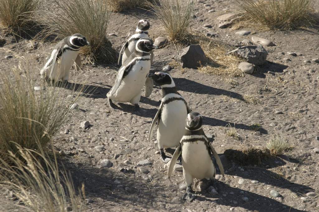
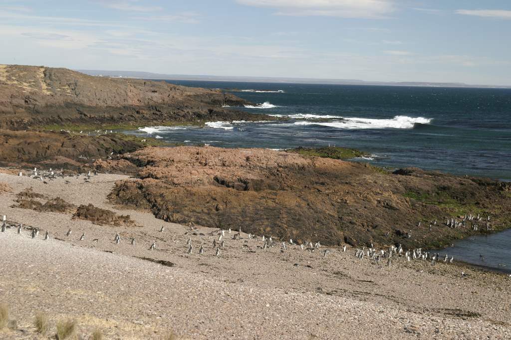 (By the way, the penguin colony, at the end of 16 miles [30km] of gravel road is
very interesting. I have it to myself except for one couple. I’ll send two
pictures for Scott to post to the web site. They are strange little creatures.)
(By the way, the penguin colony, at the end of 16 miles [30km] of gravel road is
very interesting. I have it to myself except for one couple. I’ll send two
pictures for Scott to post to the web site. They are strange little creatures.)
At Camarones, I’m still 1,100 miles (1,800km) from Ushuaia and after seeing the
penguins it’s almost noon on Wednesday before I pull out of town. I plan to be
in Ushuaia by Christmas Eve to allow myself four days of rest and relaxation
before leaving for Chile. I need to keep moving. I check my tires before I
leave, and assure myself that I’ll easily make the city of Rio Gallegos and plan
to install the Continental TKC-80s that I’ve been carrying since Buenos Aires.